Sakibur Rahman
12.46° S · 130.84° EDarwin, Northern Territory

Mapping the Top End, one layer at a time.

Environmental scientist and GIS analyst working on vegetation, landscapes and environmental change in northern Australia.

GIS & remote sensing NT fieldwork Environmental compliance Community engagement
Selected workProblem · Data · Result

Projects

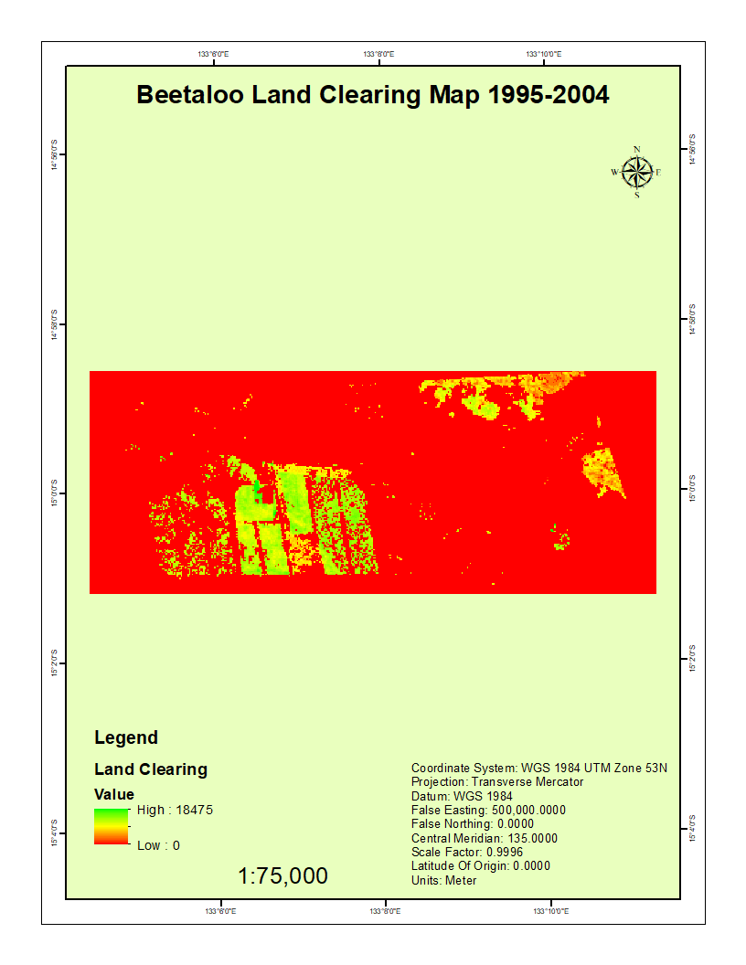
Map of detected land clearing in the Beetaloo region, 1995–2004
Master's research · Charles Darwin University

Detecting vegetation clearing in the Beetaloo region, NT

  • Google Earth Engine
  • Landsat 5 TM
  • NDVI change detection
  • ArcGIS
Problem
Clearing of native vegetation in the Northern Territory threatens biodiversity and cultural values, and unlicensed clearing is hard to track across remote country. I asked how much native vegetation was cleared in part of the Beetaloo region, about 500 km south-east of Darwin, between 1995 and 2004, and where.
Data
Two cloud-free Landsat 5 Thematic Mapper surface reflectance scenes (Path 106, Row 69, 30 m resolution) from 10 September 1995 and 15 September 2004, accessed through Google Earth Engine.
Methods
Applied cloud and shadow masking with the QA band, calculated NDVI for each date, and subtracted them to produce a change image (ΔNDVI = NDVI 2004 − NDVI 1995). Classified significant vegetation loss using a standard-deviation threshold (ΔNDVI < μ − 1.5σ), checked against RGB composites and NDVI histograms. Final maps produced in ArcGIS.
Result
Detected about 71,759 m² (≈7.2 ha) of native vegetation clearing, concentrated in the central and southern parts of the study area and linked to pastoral and infrastructure development. Patches of regrowth appeared along drainage lines and riparian areas. The study shows that NDVI differencing in Google Earth Engine is a fast, low-cost way to monitor clearing in northern Australian savannas.
View the Landsat scenes
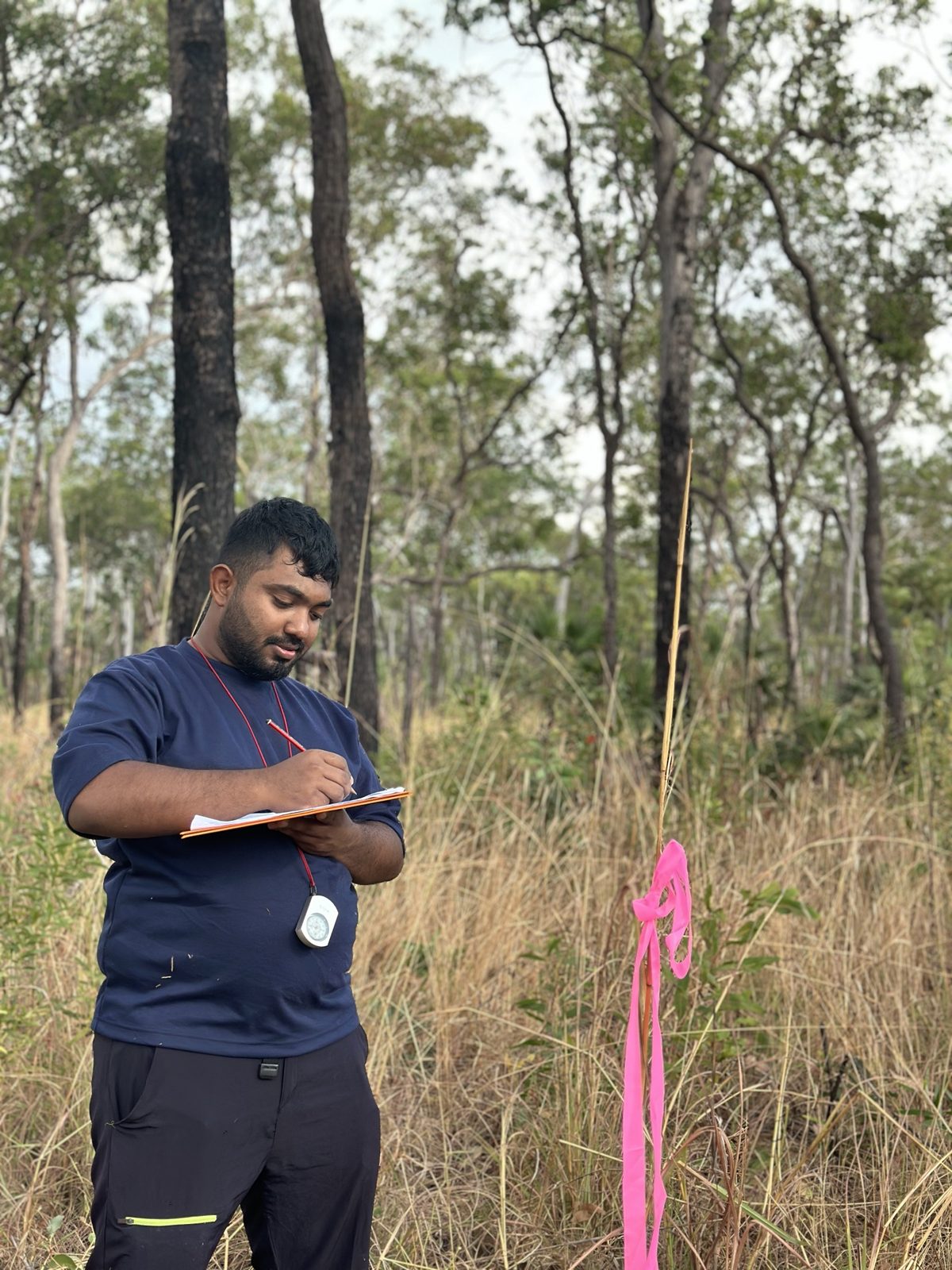
Sakib recording field data at a savanna survey plot in the Top End
Field ecology · Charles Darwin University

Fire, rainfall and savanna structure across the Top End

  • Field survey
  • Vegetation structure
  • Microsoft Excel
  • Statistical analysis
Problem
Fire and rainfall shape the structure of northern Australia's monsoonal savannas, which affects habitat for wildlife and how woodlands regenerate. Our team asked which trees dominate under different fire regimes, whether sites hold large habitat trees, how vulnerable young trees are to fire, and how fire and rainfall relate to ground cover.
Data
Field surveys at six sites across a rainfall gradient (about 860 to 1,860 mm a year), with paired high-burn and low-burn sites at Litchfield, Douglas-Daly and Mataranka. We measured tree species, diameter at breast height (DBH), tree height, basal area of the top and middle layers, and visual ground cover.
Methods
Importance Value Index (IVI) to rank dominant species; DBH threshold analysis (20 cm) for habitat potential; escape-height analysis (4 m) for juvenile trees; correlation and multiple regression for ground cover, fire and rainfall; paired t-test comparing basal area of the top and middle layers. My role: Team member.
Result
Eucalyptus tetrodonta and E. miniata ranked highest by importance value, and eucalypts made up a larger share of trees at the high-fire site in every region. About 40% of trees were above the 20 cm DBH habitat threshold, but around 70% of juvenile trees were below flame height, which signals a regeneration risk under frequent fire. Ground cover was higher at high-burn sites, and top-layer basal area was significantly greater than the middle layer (p < 0.05).
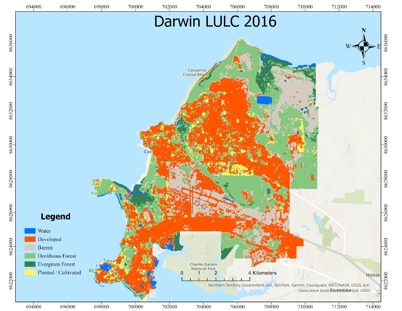
Land use and land cover map of Darwin, 2016
GIS project · Charles Darwin University

Urban growth and vegetation change in Darwin, 2016–2023

  • ArcGIS Pro
  • Landsat 8
  • NDVI
  • Land cover mapping
  • Cartography
Problem
Darwin's urban footprint has grown steadily, replacing native vegetation and affecting runoff, urban heat and habitat. I asked how land cover and vegetation health changed across the Darwin municipality between 2016 and 2023.
Data
Landsat 8 imagery from USGS EarthExplorer (cloud cover under 5%) for 2016, 2019 and 2023, plus administrative boundaries and topographic data from the NT Government spatial data repository.
Methods
In ArcGIS Pro, applied atmospheric correction and QA-band cloud masking, calculated NDVI with the Raster Calculator ((Band 5 − Band 4) / (Band 5 + Band 4)), built median composites for 2016–2019 and 2020–2023, and compared them to detect change. Produced land use and land cover maps (water, developed, barren, forest, planted) and finished map layouts with legends, scale bars and grid coordinates.
Result
Built-up areas expanded between each period, mainly at the expense of vegetated land, while water bodies stayed stable. The highest NDVI values across the study area fell from 0.69 in 2016 to 0.65 in 2019 and 0.60 in 2023, consistent with declining vegetation as the city grew. The project shows how routine Landsat monitoring could support urban planning in Darwin.
SRReplace with your photo
AboutDhaka → Darwin

From geography in Dhaka to fieldwork in the Top End

I'm Sakib, an environmental professional based in Darwin. I studied Geography and Environmental Management at the University of Dhaka, then completed a Master of Environmental Management at Charles Darwin University as a Global Merit Scholar.

My work combines GIS and remote sensing with time in the field. I'm interested in how spatial data can help people understand and look after northern Australian landscapes, from vegetation and wetlands to how places change over time.

I enjoy turning complex environmental data into clear maps and practical advice that land managers, communities and decision-makers can use.

Toolkit

Skills

GIS & spatial analysis

  • ArcGIS Pro
  • QGIS
  • Spatial analysis and cartography
  • Map layouts and web maps

Remote sensing

  • Satellite image processing
  • Vegetation indices (e.g. NDVI)
  • Land-cover classification
  • Change detection

Field & environmental

  • Fieldwork in NT landscapes
  • Data collection and survey design
  • Environmental compliance
  • Environmental management

People & communication

  • Community engagement
  • Report writing
  • Presenting findings to non-specialists
  • Working across cultures
Route so far

Education & experience

From January 2027

Graduate Program, George Brown Darwin Botanic Gardens

NT Department of Tourism and Hospitality.

Completed December 2025

Master of Environmental Management

Charles Darwin University · Global Merit Scholar

Completed 2022

Bachelor of Science, Geography and Environmental Management

University of Dhaka

Contact

Let's talk about maps, landscapes or your next project

I'm happy to connect with people working in environmental management, GIS and conservation across the Northern Territory and beyond.